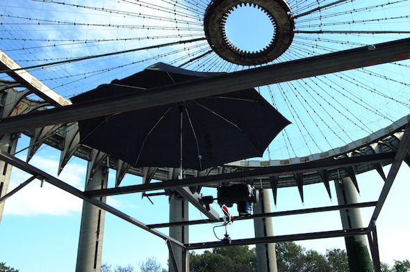
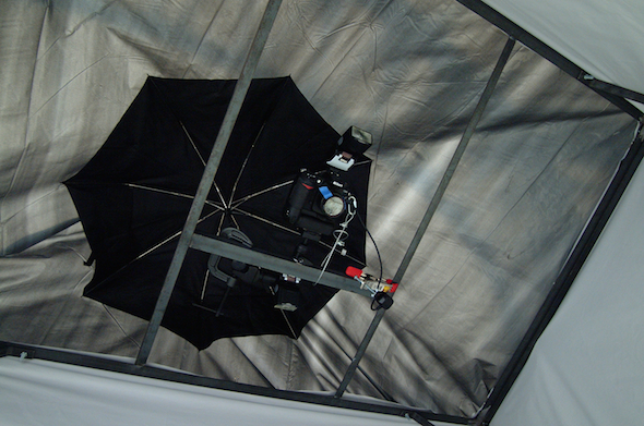
The State of New York, aerial survey, New York State Pavilion, Flushing Meadows Corona Park, Queens, New York, 11–13 October 2006, 2,427 vertical photographs
The State of New York is an aerial survey of the whole State of New York from an altitude of seven feet. The survey records the surface of a giant copy of a road map of the Empire State which was inlaid in the terrazzo floor of the New York State Pavilion for the 1964–65 World’s Fair. The pavilion, designed by Philip Johnson and advertised as the ‘Tent of Tomorrow’, now stands derelict in Flushing Meadows Corona Park, Queens. The archive of photographs forms the basis of a series of works which reflect on a map in the process of turning back into a landscape.
Related works
![]() Index
Index
![]() Emperor Panorama
Emperor Panorama
![]() Untitled (Cities and Empires)
Untitled (Cities and Empires)
![]() The State of New York
The State of New York
![]() Mosaic
Mosaic
Anthony Auerbach would like to thank: Marlene Haring, co-pilot for the photographic mission; Valerie Smith and colleagues at the Queens Museum of Art, for supporting the idea and supervising the work; John Krawchuk and Sybil Young of New York City Department of Parks & Recreation, who arranged access to the site; Frank Matero and John Hinchman of the Architectural Conservation Laboratory at the University of Pennsylvania for co-ordination of calendars.